Lac Blanc: The Mont Blanc Range From the Other Side
Auvergne-Rhône-Alpes, France
Badge Unlock
Lac Blanc Mirror
Complete this challenge to add this badge to your collection.
300
XP
+100 France
= 400 total
1 day
Lac Blanc: The Mont Blanc Range From the Other Side
300 + 100 XP
Lac Blanc lies at 2,352m in the Aiguilles Rouges above Chamonix, inside the national nature reserve, with the Aiguille du Belvédère and the Aiguilles Crochues above it. It faces straight across the valley at the Mont Blanc massif — the Aiguille d'Argentière, the Aiguille Verte, the Argentière glacier and the Mer de Glace all in one view — and on a still morning the whole range lies in the water.
Required Activities
1
of 5
Take the gondola out of Les Praz over the golf course up to la Flégère, then do the part the lift cannot: seven kilometres and five hundred metres of climbing, about three hours, past the chalets and the little lake at la Flégère at 2,027 m, to the Lac Blanc at 2,352 m
2
of 5
Work out which of the two lakes you are looking at — Lac Blanc is two sheets of water joined by a short stream, and the upper one is often still frozen over in midsummer — then wait for the lower one to go still and get the Mont Blanc range in it
3
of 5
From the shore, name the opposite wall left to right: the Aiguille d'Argentière with the Argentière glacier under it, the Grands Montets, the Aiguille Verte, the Aiguilles de Chamonix, and the Mer de Glace coming down at the far end
4
of 5
Spend ten minutes with binoculars on the scree and the skyline: ibex and chamois on the slopes of the Aiguilles Rouges, ptarmigan on the stony ground where they are almost invisible, and golden eagles working the thermals over 3,276 hectares that have been a national reserve since August 1974
5
of 5
Find the refuge and work out why it stands back from the water behind a rock buttress — the first one was built right on the shore and an avalanche took it away in 1986 — then turn your back on Mont Blanc and name what is above you instead: the Aiguille du Belvédère at 2,965 m, the highest point of the Aiguilles Rouges, with the Aiguilles Crochues to the west
Take the gondola out of Les Praz over the golf course up to la Flégère, then do the part the lift cannot: seven kilometres and five hundred metres of climbing, about three hours, past the chalets and the little lake at la Flégère at 2,027 m, to the Lac Blanc at 2,352 m
Work out which of the two lakes you are looking at — Lac Blanc is two sheets of water joined by a short stream, and the upper one is often still frozen over in midsummer — then wait for the lower one to go still and get the Mont Blanc range in it
From the shore, name the opposite wall left to right: the Aiguille d'Argentière with the Argentière glacier under it, the Grands Montets, the Aiguille Verte, the Aiguilles de Chamonix, and the Mer de Glace coming down at the far end
Spend ten minutes with binoculars on the scree and the skyline: ibex and chamois on the slopes of the Aiguilles Rouges, ptarmigan on the stony ground where they are almost invisible, and golden eagles working the thermals over 3,276 hectares that have been a national reserve since August 1974
Find the refuge and work out why it stands back from the water behind a rock buttress — the first one was built right on the shore and an avalanche took it away in 1986 — then turn your back on Mont Blanc and name what is above you instead: the Aiguille du Belvédère at 2,965 m, the highest point of the Aiguilles Rouges, with the Aiguilles Crochues to the west
Before you go
No dogs, at all: the whole route is inside the Aiguilles Rouges nature reserve, where dogs are banned even on a lead, so if you are travelling with one this is the walk to skip. Chamonix grades the path red — difficile — at 7 km and 500 m of climbing, about three hours up, and says outright that it depends on snow and weather: the upper lake regularly stays frozen late into the summer. The Flégère gondola runs from late June to mid-September only, and a return to the Flégère is around twenty-five euros for an adult, more if you go on to the Index. The reserve's visitor chalet at the col des Montets is free and open from 1 June to 15 September.
Finding nearby campsites...
About Auvergne-Rhône-Alpes
Loading region info…
Explore more about Auvergne-Rhône-Alpes:
Challenge Location
XP Breakdown
Challenge XP
300 XP
France country bonus
+100 XP
Potential total
400 XP
Country bonus earned on completion of your first challenge in France.
More challenges nearby
within 100km

The Cirque du Fer-à-Cheval and Samoëns: Thirty Spring Waterfalls and the Stonemasons' Village
France · Auvergne-Rhône-Alpes
nature
easy
1d
10 km away

Chamonix: The Aiguille du Midi and the Mer de Glace
France · Auvergne-Rhône-Alpes
scenic
medium
2d
12 km away
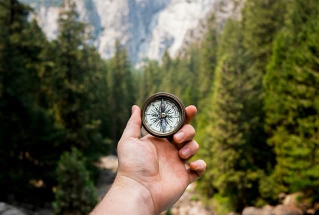
The Tour du Mont Blanc: The First Stage Over the Col de Voza
France · Auvergne-Rhône-Alpes
adventure
hard
1d
12 km away
Mont Blanc Adventure
Italy · Valle d'Aosta
adventure
hard
5d
16 km away
Avoriaz: The Resort Built to Look Like the Mountain
France · Auvergne-Rhône-Alpes
cultural
easy
1d
25 km away
Alpine Wellness Retreat
Italy · Valle d'Aosta
wellness
easy
4d
25 km away